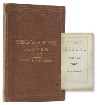
Tourist's Guide Book to Denver
Denver: Times Steam Printing House & Blank Book Manufactory, 1882. First edition. Read More about Tourist's Guide Book to Denver
Price: $2,500
Denver: Times Steam Printing House & Blank Book Manufactory, 1882. First edition. Read More about Tourist's Guide Book to Denver
Price: $2,500
Philadelphia: Thomas, Cowperthwait & Co, 1852. Mitchell & Sons first published their NEW UNIVERSAL ATLAS in 1846 (having acquired Tanner’s NEW UNIVERSAL ATLAS in 1845) and printed it several times subsequently until 1850 when the firm sold the rights to Cowperthwait & Co. of Philadelphia, who published it until 1856..... Read More about A New Universal Atlas Containing Maps of the Various Empires, Kingdoms, States and Republics of...
Price: $10,000
London: Printed for Longman, Rees, Orme, Brown, Green, and Longman, n.d. Eighteenth Edition. Read More about Paterson’s Roads; Being An Entirely Original and Accurate Description of All the Direct and...
Price: $300
[London: John Bowles, n.d., ca. 1730’s]. An undated broadside advertisement by publisher John Bowles for an edition of Herman Moll's atlas THE WORLD DESCRIBED, listing the 28 maps contained therein and advertising 5 other cartographic works printed by Bowles. This broadside is sometimes found pasted in copies of the atlas..... Read More about The World Described : or, a New and Correct Sett of Maps
Price: $2,250
New Haven: Printed and Published by Nathan Whiting, 1823. Originally published as “The American Gazetteer” in 1797. Read More about The Traveller's Guide: or Pocket Gazetteer of the United States
Price: $275
Troy, New York: Printed by Parker and Bliss, 1814. With the early printed booklabel reading “The Property of William Carpenter, Rehoboth, Mass. 18[14]” (with the “14” filled in in ink with inked price). Read More about Geography made Easy: being an Abridgement of the American Universal Geography
Price: $250
Boston: Redding & Co.; New York:Clark, Austin & Co, 1849. Each of the railroad lines is identified. Read More about Railroad Map of New England & Eastern New York Compiled from the most authentic sources
Price: $400
Augsburg: Tobias Conrad Lotter, 1777. This map is Lotter's German edition of Sauthier's map of 1776 done by William Faden. Read More about A Map of The Provinces of New-York and New Jersey, with Part of Quebec
Price: $2,500
1910. A few light penciled notes, some of which have been erased, showing mostly measurements. Read More about Map of parts of Passaic and Mendham Townships, Plate # 24. Including May P. Jones's "Marnet...
Price: $400
New York: Printed by Shepard Kollock, 1786. Republished by John Doggett Jr, 1851. Reissue of the very scarce 1786 edition. Read More about The New York Directory, containing A Valuable and Well Calculated Almanack; Tables of the...
Price: $300
St Louis: Coloney, Fairchild & Co, 1867. Very Rare Cartographic Business Directory of Broadway. In 1866, St. Louis publishers and mapmakers Coloney and Fairchild issued a ribbon map of the entire length of the Mississippi River, titled Ribbon Map of the Father of Waters. Its commercial success prompted the firm..... Read More about Ribbon map of New York City: containing a complete description of all the points of interest,...
Price: $10,000
New York: Published by J. Disturnell, 1842. Detailed insets of New York with part of Brooklyn and Williamsburg, the vicinity of New York and the St. Lawrence River. Read More about Map of the State of New York showing the Boundaries of Counties & Townships, the Locations...
Price: $600
[N.p: ca. 1590]. Abraham Ortelius (1527-98) was a Flemish geographer of German origin. His major work, Theatrum Orbis Terrarum (1570, with later revisions and addendums), was the first modern atlas. It was based on contemporary charts and maps, and contained a collection of plates engraved by Frans Hagenberg in a...... Read More about Barbariae et Biledulgerid, Nova Descriptio. Double-page map of North African region of Libya and...
Price: $450
London: Priestley and Weale and by the Author, 1829. Map of Ancient Coins. The large and wonderful Atlas, the only one of its kind we have seen, was done by Richard Benjamin Green (1808-18760), watercolorist, portrait and landscape artist, lecturer, drawing instructor, and apparently, a student of ancient coins. Read More about A Numismatic Atlas Comprising a Series of 360 Grecian Coins of Kings Arranged in Chronological...
Price: $1,500
Cincinnati, Ohio: E. Mendenhall 157 Main Street, 1867. Read More about Railway and Township and Map of Ohio
Price: $550
np: [c. 1590]. Abraham Ortelius (1527-1598) was a Flemish geographer of German origin. His major work, Theatrum Orbis Terrarum (1570, with later revisions and addenda) was the first modern atlas. It was based on contemporary charts and maps, and contained a collection of plates engraved by Franz Hagenberg in a...... Read More about Angliae, Scotiae, et Hiberniae, sive Britannica Insularum Descriptio. Double-page Map of England,...
Price: $750
London: Sold by J. Wyld, c. 1848. Read More about Fox Hunting Map of Oxfordshire. Places of the Meeting of Foxhounds. No. 28
Price: $300
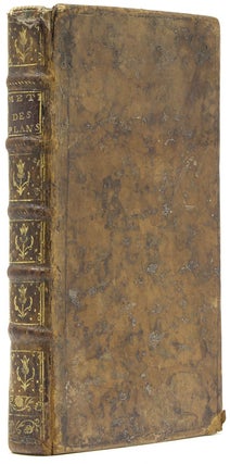
Paris: Quay des Augiustin...Jombert, 1750. Nouvelle edition. Jacques Ozanam (1640-1718) was self-taught maths teacher. This book was very popular and was first published in 1693. There are several chapter on mapping the sea. Read More about Methode de lever les Plans et les Cartes du terre et de mer avec toutes sortes d'instrumens, et...
Price: $500
Paris: Chez l'Auteur, 1817. Second edition. Read More about Dictionnaire Topographique des Environs de Paris, jusqu'à 20 lieues a la Ronde de Cette Capitale
Price: $300
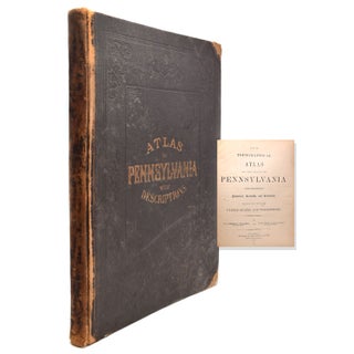
Philadelphia: Published by Stedman, Brown & Lyon, 1872. Read More about New Topographical Atlas of the State of Pennsylvania with descriptions Historical, Scientific and...
Price: $600
Philadelphia: Stedman, Brown & Lyon, 1872. Read More about New Topographical Atlas of the State of Pennsylvania with descriptions Historical, Scientific and...
Price: $950
np: U.S.G.S. Edition of 1902 reprinted in October, 1908. Read More about Smith's Map of Philadelphia and Vicinity
Price: $150
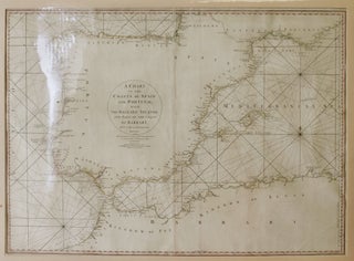
London: Wm. Faden, Successor to the Late T. Jeffrys, Geogr. to the King, June 28th, 1780. Second edition. Read More about A Chart of the Coasts of Spain and Portugal with the Balearic Islands and Part of the Coast of...
Price: $300