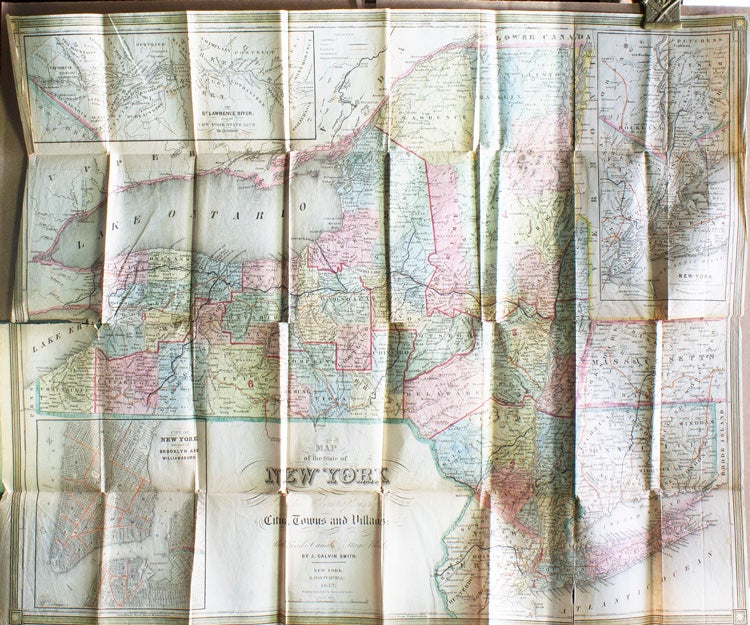
Map of the State of New York showing the Boundaries of Counties & Townships, the Locations of Cities, Towns and Villages: Rail Roads, Canals, Stage Roads.
New York: Published by J. Disturnell, 1842.
Price: $600.00
About the item
Handcolored map engraved by Sherman & Smith. 1 vols. 12mo folder 18 x 19 inches (map). Original green cloth, title lettered in gilt on upper cover, with folded map. Some tears and holds along a few folds and along the edges, creased, light browning and offsetting, else very good, with the bookplate of Charles George Moller, Jr.
Item #34300
Detailed insets of New York with part of Brooklyn and Williamsburg, the vicinity of New York and the St. Lawrence River.